Route comparison
Field notes describe surface, shade, wind exposure and access points for each trail, so two routes can be set side by side on the things that actually decide a day: loose stone, tree cover, an open ridge, a gap in a wall.
The trail index is built by hikers, trail runners and cyclists who walk, run and ride these routes themselves. That shapes what each entry tells you and what it leaves out.
Packed earth, loose limestone, polished rock, compacted gravel. Notes say how the ground actually feels underfoot, including where it turns slick after rain.
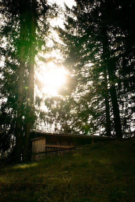
Continuous pine cover on one climb, none at all on the ridge. Exposure is flagged where it matters, so you can plan around midday sun or a headwind.
Where a route starts, where it links to the next one, and where the entry is clear but unmarked. Useful when you are comparing two options for the same afternoon.
Image sequences are shot on foot across different visits, so the same path appears dry, wet, in low winter light or under full summer sun.
Captions name the surface, the light and the place. Nothing is dressed up, because the people reading already know what a limestone path looks like.
Entries work as route comparison for a trip, and as a starting point for licensing or print requests. The contact form handles both, plus new photo sets.
Start with the shaded climb on the Pine Track Above Pupnatska Luka, or see how the same ground is documented across route comparison and licensing.
Every entry is made by people who already walk, run and ride these routes. That is why the notes stay plain: a runner wants to know how the ground feels underfoot, a cyclist wants to know where access opens and closes, a hiker wants to know how much shade and wind a stretch carries. The gallery is organised by trail, not by date, so you can compare one route against another before you commit to a day out.
Field notes describe surface, shade, wind exposure and access points for each trail, so two routes can be set side by side on the things that actually decide a day: loose stone, tree cover, an open ridge, a gap in a wall.
Image sequences are shot on foot over several seasons, so the same ground appears in dry summer light and in wet winter shadow. Useful when you are working out timing, footwear or how early a shaded climb needs to start.
Plates from the index are available for print and licensing. Tell us the trail entry and the intended use, and we will come back with the terms that fit that specific set of images.
If you have a set from a route you know well, send it in. Submissions are reviewed against the trail index before anything is added, and the caption stays as specific as the ground it describes.
Questions about a specific path, a narrowing above a cove or a link between two trails are welcome. Name the entry and describe what you are trying to work out, and the answer stays tied to that route.
Contributors are hikers, trail runners and cyclists who know the ground. That is the whole editorial standard here: no promotional language, no invented detail, just what the surface, the shade and the wind do on a given stretch.
We use a small amount of browser storage to remember how you responded to this notice. It keeps the banner from appearing on every visit and helps the site behave consistently. Nothing is shared with advertising networks, and you can change your mind later by clearing your browser data. Read the details in our privacy policy.